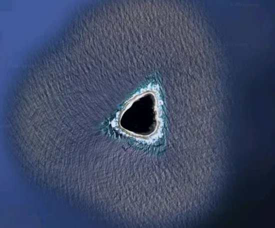
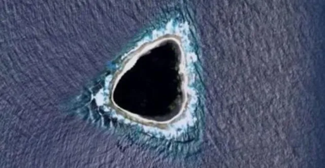
On social media, many viewers were stunned by the mysterious ‘blacked out’ island on Google Maps.
On Reddit, users are discussing this enigma, but no one knows its origin.
A peculiar feature on Google Maps has caught the attention of users worldwide.
It is an island that appears completely blacked out, leaving viewers stunned.
This enigmatic atoll has sparked numerous theories and speculations. It captivates the imagination of those who stumble upon it.
The enigmatic atoll was captured on Google Map
Google Maps is renowned for its detailed mapping of the globe.
It showed a wide array of intriguing and often mysterious locations.
Users have noted oddities such as blurred houses and inaccessible roads. Now, they have discovered an island that is entirely blacked out.

On Reddit flatform, a user, who goes by @kokoblocks shared mysterious blacked-out island on google maps.
The post has the caption: “what the F**K this looks nothing like an island”
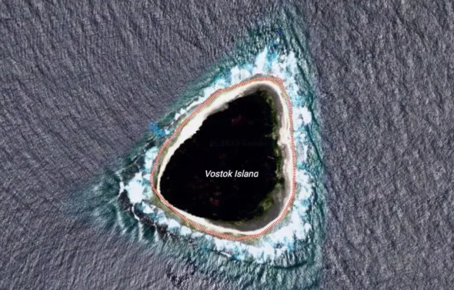
Although this feature has piqued interest, its exact location remains unknown, and it is technically classified as an atoll.
It is characterized primarily by a surrounding reef rather than traditional land.
The post quickly went viral and sparked theories abound.

Many users have speculated about the reason behind the blacked-out area.
One popular theory suggests that the island may be a refuge for aliens.
This possibility raises questions about the island’s significance and potential privacy concerns.
Additionally, these lighthearted theories add a layer of entertainment to the mystery.
One person said: No it doesn’t. Not atoll.
A second wrote: It’s surrounded on three sides by water, making it a peninsula.
While a third commented: Scrolling past I thought it was a hole in a leather seat.
Another aded: An island is a land mass surrounded by sea….that looks exactly like an island.
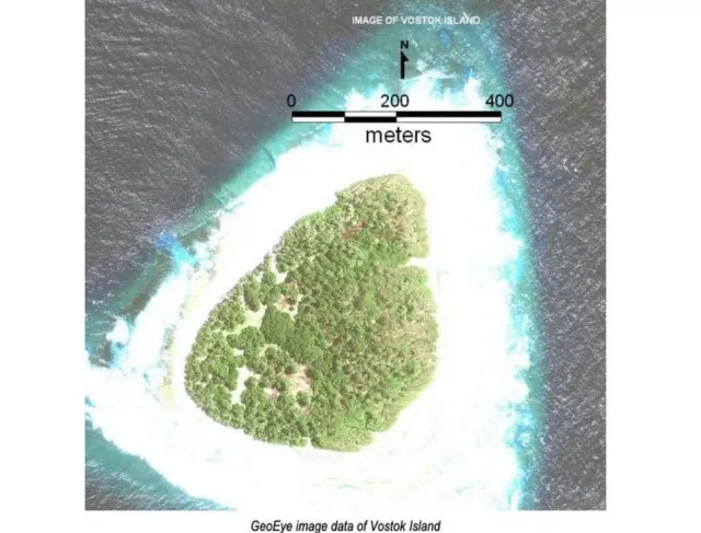
Someone else said: It’s Vostok Island. It’s covered all over in tall dense tress. It’s a rendering error by assuming the trees are sea.
The truth behind a mysterious blacked-out island on Google Maps

While, a Reddit user provided a more technical perspective. They stated: “The blue color around the island is a painted-in color so the oceans look uniform on the maps. Islands are added by erasing some of that blue to let the satellite image show through.”
This explanation suggests that the odd appearance could be due to mishandling of the mapping process.
While, it indicates that there may be no secretive or supernatural cause behind it.
The mysterious blacked-out island on Google Maps continues to intrigue and amuse users. It prompted that various theories about its existence.

This is a result of censorship, a mapping error. It simply an oddity of nature, one thing is clear:
Additionally, curiosity surrounding this atoll is unlikely to fade anytime soon.
As users continue to ponder its significance, it reveals many mysteries that still exist in our mapped world.