On social media, many viewers were stunned by the map for ‘time travelers’ as the best thing they’ll see on the internet today.
A new interactive map has taken the internet by storm. Say goodbye to Google Maps and Apple Maps.
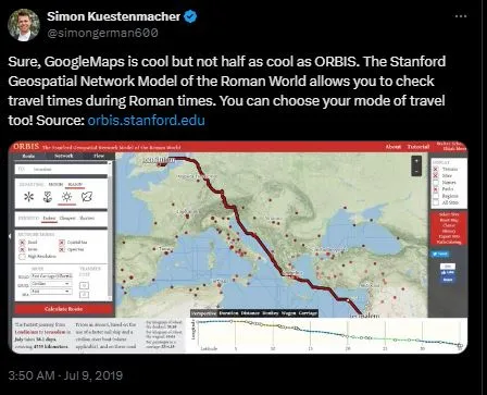
ORBIS, created by Stanford University, allows users to explore travel times in the Roman world. This unique geospatial network model provides a fascinating glimpse into ancient travel.
ORBIS explored the Roman world
ORBIS enabled users to calculate travel durations between locations during Roman times. Imagine being transported back to 200 CE with access to a 4G network.

With ORBIS, you can determine how long it would take to travel from Londinium to Corinthus by ox. You can also calculate the time needed for a military march from Augusta Treverorum to Alexandria.
This map isn’t just about time; it also details the costs associated with each journey.
The importance of cost and connectivity is essential to understand.
Stanford emphasizes that traditional maps fall short in capturing the environmental constraints of the Roman era.
They noted, “Cost, rather than distance, is the principal determinant of connectivity.” This insight highlights the complexities of travel in ancient times.
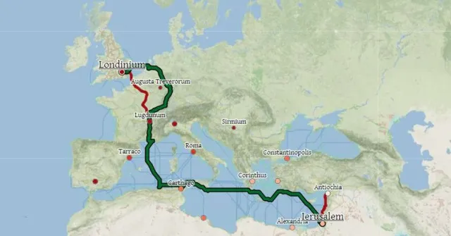
A journey from Londinium to Ierusalem

Curious about the journey from Londinium to Ierusalem, we explored how long it would take. We chose to travel by donkey and boat during winter.
According to modern estimates, a car would take 52 hours. A plane, if it had existed, would take only 6 to 8 hours. However, in Roman times, the journey was significantly longer.
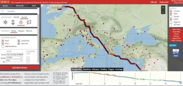
“The fastest journey from Londinium to Ierusalem in January takes 53.5 days, covering 5,433 kilometers (3,375 miles).”
Costs of Ancient travel

Traveling in ancient times came with costs based on the mode of transportation. Here are some pricing details in denarii:
– Per kilogram of wheat (by donkey): 22.74
– Perkilogram of wheat (by wagon): 27.45
– Per passenger in a carriage: 1,897.51
For the cheapest route, the journey would take 98.4 days over a distance of 6,129 kilometers (3,303 miles). You would save nearly 1,000 denarii per passenger and 7 denarii per kilogram of wheat. After all, what’s a holiday without a wagonload of wheat as a souvenir?
Check out the ORBIS map for yourself.

It’s an engaging tool that has captivated internet users over the past week. Whether you’re a history novelist or an aspiring time traveler, this map is an essential resource.
The ORBIS interactive map offers a unique insight into Roman travel. By revealing travel times and costs, it enriches our understanding of ancient connectivity. Dive into this fascinating world and explore the challenges of travel in Roman times.