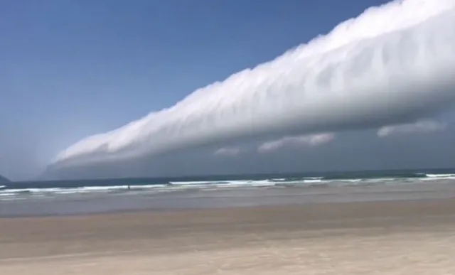
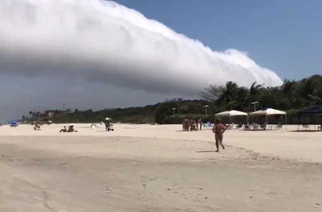
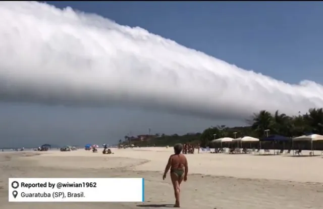
On social media, many viewers were stunned after a video captured the moment showing a rare roll cloud in the sky.
A stunning visual of a roll cloud
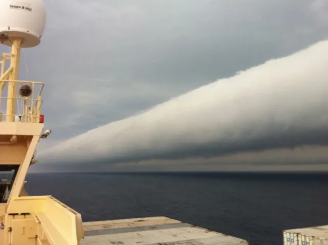
A rare and beautiful roll cloud was recently captured in a stunning photograph near Brazil.
This particular roll cloud photo was taken by Captain Andreas M. van der Wurff on February 6.

The photograph was snapped while he was aboard a ship traveling from Paranagua, Brazil, to Montevideo, Uruguay.
This tubular cloud appears to tumble across the sky, creating a mesmerizing sight.
The photo, taken last month, was featured on NASA’s Earth Science Picture of the Day blog. Roll clouds are a type of arcus cloud, known for their low and unique formations
Many viewers stunned by roll cloud
One person said: In the beginning i thought its a tsunami.

A second wrote: Bro, roll clouds are further out from storms.. Shelf clouds are literally attached to them. Two different things.
While a third commented: Wow that seriously looks so scary but cool. Wish first clip focused on it coming towards them instad of the side view but still looks cool
Another added: The dark part is terrifying. I have MEGALOPHOBIA
What are roll clouds and how do they form?
Roll clouds are often mistaken for other cloud types, but they are distinct in their formation.

They are part of the arcus cloud category, which also includes shelf clouds commonly seen at the leading edges of thunderstorms.
https://youtu.be/xomE2jiJegs?si=0NpqAd0n83VKhHR9
Roll clouds form when sinking cold air from a storm causes warm, moist air near the Earth’s surface to rise.
As this air reaches higher altitudes, the moisture condenses into cloud form.
Winds from the storm roll the cloud parallel to the horizon, creating an effect that resembles a horizontal tornado. Unlike shelf clouds, roll clouds are completely detached from the storm.
Roll clouds are often harmless

While roll clouds are impressive, they are not dangerous in themselves. Many roll clouds form in calm weather, especially near coastal regions.
For example, the Morning Glory roll cloud is a regular occurrence in Queensland, Australia, during fall months.
Roll clouds are just one example of the fascinating weather phenomena caused by unique wind patterns.
Wave clouds, for instance, resemble ripples in the sky. They form when an air mass is forced to rise by a landmass such as a mountain, cooling the air and causing condensation.
Lenticular clouds are another incredible sight. These smooth, round clouds are often mistaken for UFOs.
They form due to winds around mountain peaks, creating a remarkable cloud formation.
Roll clouds and other unusual weather phenomena highlight the incredible diversity of Earth’s atmospheric processes.
While not all of them are dangerous, these rare occurrences remind us of the dynamic nature of our planet’s weather systems.